| Pick
domain: |
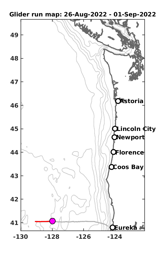
Map
|
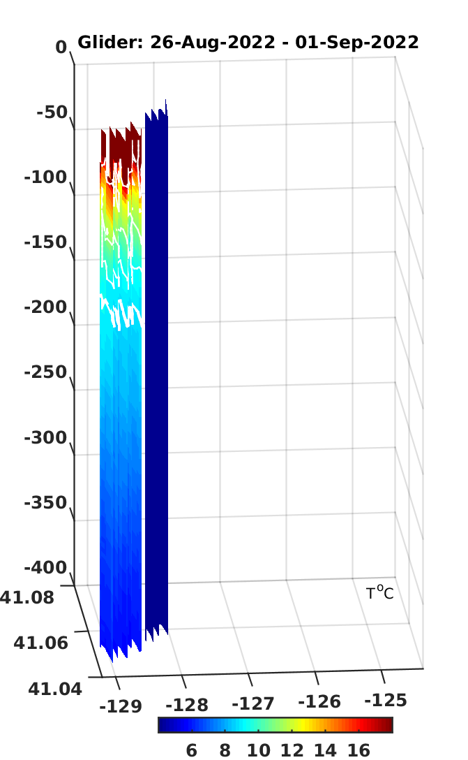
Glider
profile |
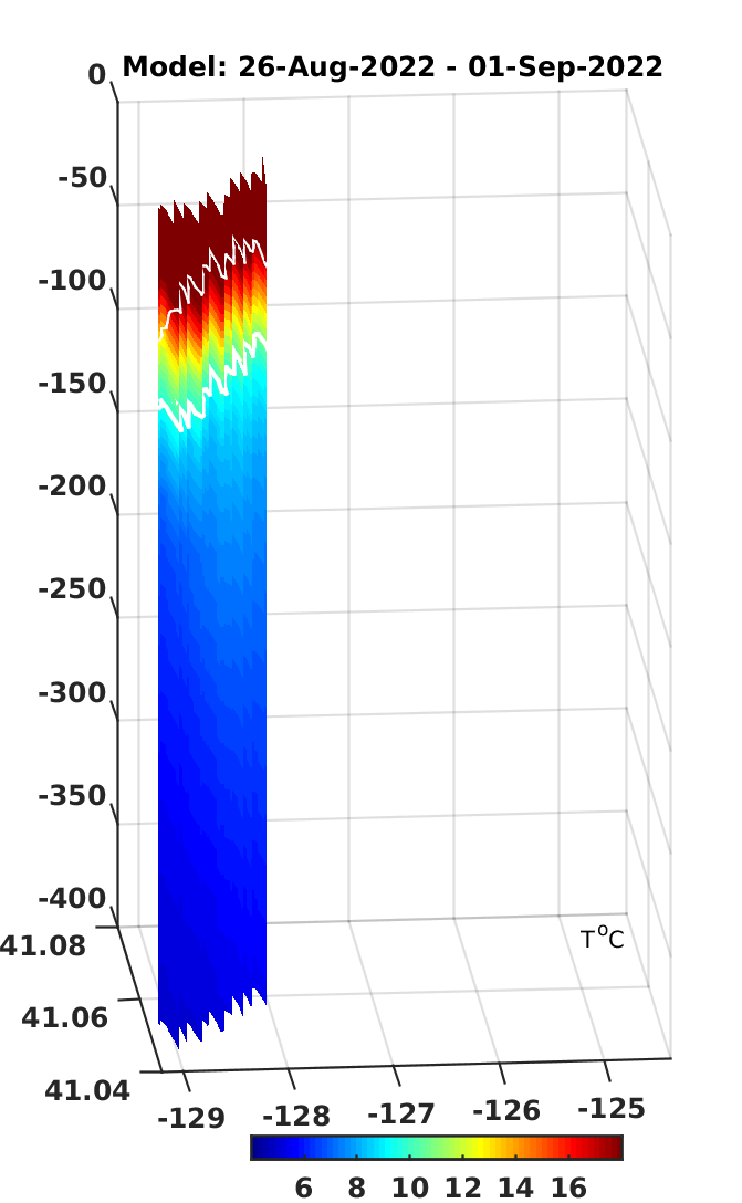
Model
profile |
| Pick
date |
 |
 |
 |
| |
|
|
|
|
|
Ocean Forecast Model: Regional Ocean Modeling System (ROMS, 2-km horizontal resolution)
Assimilation
system: OSU AVRORA, the 4-dimensional
variational data assimilation method
SEAGLIDER data:
Glider Research Group
|
||
| |
Assimilated
data: - High frequency (HF) radar surface currents (P.M. Kosro) - Sea surface temperature (SST), ACSPO Global SST from VIIRS - Satellite alongtrack altimetry - SSH from RADS multiple missions |
Atmospheric
forcing: - 12-km resolution NOAA NAM; |
|